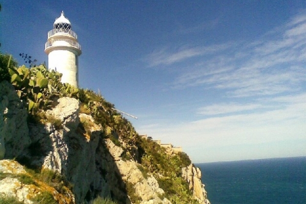
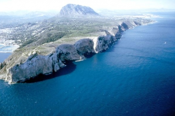
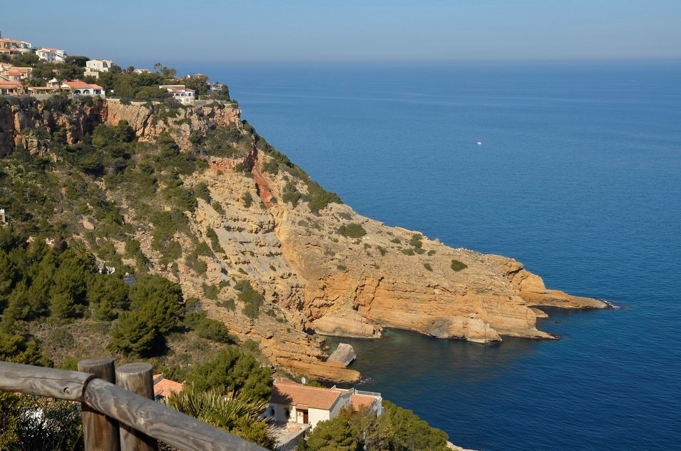
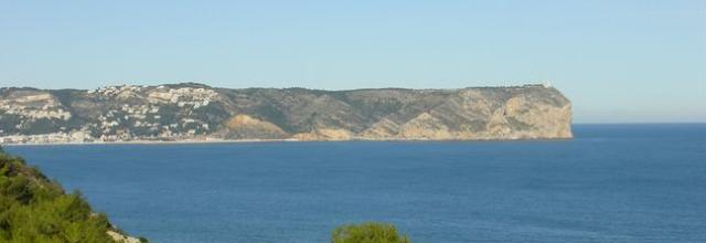
The Cape San Antonio is a breathtaking headland between Montgó mountain and the sea which was declared a nature reserve in 1993.
Cap de Sant Antoni
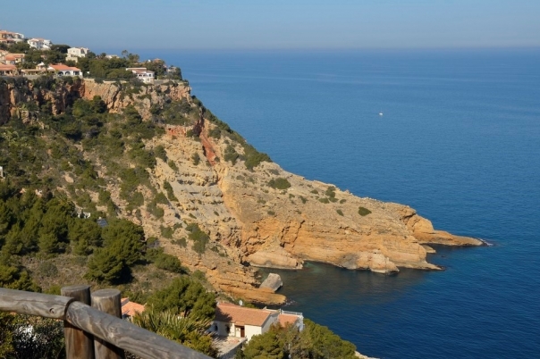
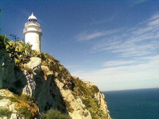
The sea and a clean horizon of surprising beauty dominate the landscape of Xàbia. To get the best views, there are no better vantage points than the 15 tourist lookout points (Miradores) at Els Molins, Cap de Sant Antoni, Punta del Castell, Séquia de la Nòria, Cala Blanca, Caletes, Portitxol, L'Illa, La Falzia, Cap Negre, Cap de la Nau, Les Pesqueres, Ambolo, Castell de la Granadella and Granadella cove.
The Cape San Antonio is a headland between Montgó mountain and the sea. It was declared a nature reserve in 1993 and occupies an area of 110 hectares, situated opposite & to the north of the town of Javea. The marine area around the base of the cape is a marine park consisting of a number of ecologic systems. Motorised vessels are prohibited to sail in this marine park and you need permission to dive here.
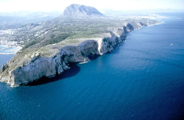
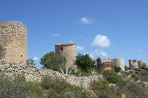
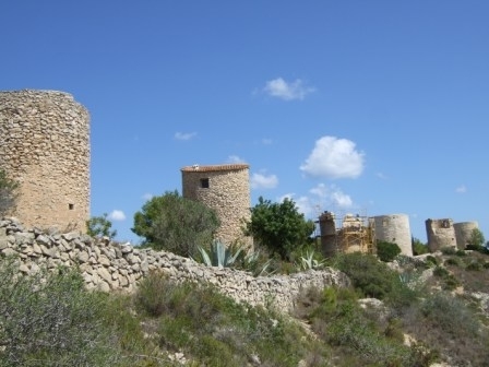
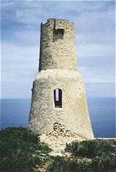
The viewpoint is easily one of the most stunning panoramic landscapes of the Valencian Coast. There are two plant microreserves here; on its north cliff face and in l´Illot de la Mona at the foot of the Cape. On the lateral sides of the plains 'Les Planes', one can still see the remains of narrow terraced areas of land which were used for the cultivation of vines. The headland offers a number of signposted walking/hiking paths and you should visit the old windmills 'Els Molins', used until the 19th century, that are currently being renovated. The south west wind, known as Llebeig, was the reason why in the XIV century the first of the windmills was constructed and which is still standing today. From the XIV to the XVIII century, ten of these cylindrical windmills were constructed for grinding wheat and other cereals. One of the hiking trails will lead you down to the Cova Tallada, which can also be reached by boat or by car followed with a short easy walk. There is also a hiking trail leading you all the way down to Javea's port.


Please complete this form to request more information.
Places to Visit in Javea
Cala en Calo Javea

Discover Cala en Calo, a stunning beach in Javea...
Markets in Javea: Easter Market & Craft Fair (April)
")
The traditional crafts fair and market takes place...
Visiting Playa La Granadella Javea in the Summer

Guide to visiting Playa la Granadella in Jávea...
Guide to Playa del Portixol / Cala Barraca Javea

Cala del Portixol, also known as Cala la Barraca,...
Capella de Santa Anna - Javea Chapel

Capella de Santa Anna is a stunning chapel in the...
Miradores de Javea: Mirador Ambolo

The quiet Mirador Ambolo showcases beautiful views...
Miradores de Javea: Viewpoint Creu del Portitxol

Positioned just above Portixol Beach, this calming...
Art Galleries and Exhibition Halls Javea

Find art galleries and exhibition halls in the...
Costa Blanca Markets: Javea Weekly Thursday Market

Visit Javea's traditional weekly market - a...
Places to Visit: Isla del Portitxol

Located within swimming distance from Cala...


 Spanish
") Chinese (simplified)
Chinese (simplified) Dutch
Dutch French
 German
 Italian
 Norwegian
 Polish
 Romanian
 Russian